The post How To Navigate In The Absence of GPS: Introducing SiPhOG and ANELLO Photonics appeared first on Techso Mogro.
]]>I talked about several episodes of the popular network comedy, “The Big Bang,” where the Caltech friends work on a gyroscope using quantum states and dynamics for navigation. When they apply for a patent, the U.S. Department of Defence comes calling.
Mario laughed and said that one of his clients had told him about it. Although SiPhOG is not using quantum states for positioning, it is achieving the same purpose, providing highly accurate navigation. SiPhOG stands for Silicon Photonic Optical Gyroscope. When this tiny sensor is put into a system, it can work to complement current global positioning system (GPS) technology or operate as a standalone solution, filling the navigation gap.
Today, GPS provides navigation assistance worldwide using a constellation of satellites and ground stations. Conceived by the U.S. Department of Defense in 1973 and fully operational by 1993, GPS uses 31 satellites, each containing an atomic clock and a transmitter that communicates with ground stations and receivers. The ground stations monitor the health of the system, correct for drift, atmospheric signal delays and changes to the satellites’ orbits.
Cars, ships, aircraft and smartphones, today, have GPS receivers to determine their locations within 30 to 500 centimetres (0.98 to 16 feet) if military grade or 7 metres (23 feet) for civilian use. Positioning requires at least four of the 31 satellites. They produce a 3-dimensional reading for the receiver’s location and determine latitude, longitude and altitude.
GPS has replaced paper maps and route planners. Its success has led Russia to copy it with GLONASS, the European Union with Galileo, China with BeiDou, India with NavIC, and Japan with QZSS. But satellite-based navigational aids don’t work everywhere. Why not? Satellite-based navigation requires a direct line of sight to the open sky. When is that not possible? It is hard to find open sky in cities with tall buildings. GPS won’t work inside buildings and underground garages, or tunnels. It cannot find hikers in dense canopied forests. Nor can it track a robot tractor spraying insecticides as it rides through a leafy orchard. Forget trying to use GPS on submarines and submersibles underwater.
This is where SiPhOG excels. Mario calls it the first new gyroscope technology to come on the market in the last two decades. Its uses include the military, aerospace, land and sea vehicles, robots, drones and more.

A single SiPhOG product is less than 25 millimetres square (see the picture at the top of this article). The integrated photonic chip inside the SiPhOG is no more than 2 by 5 millimetres (0.0155 square inches). It has low energy requirements, a mere 850 milliwatts, nearly one-tenth the power requirement of older optical gyroscopes like FOGs (fibre optic gyroscopes).
Its bias is 0.5 degrees per hour. It can be boxed in devices combined with accelerometers and other sensors, as well as AI algorithms and sensor fusion (the process of combining data from multiple sensors to produce a more reliable and accurate understanding of the environment) for enhanced navigation solutions and applications. When used in a navigation system for real-time positioning, it achieves 99.9% accurate navigation in tests involving distances of 100 kilometres (approximately 62 miles) for land vehicles.
Older optical gyroscopes like FOGs (fibre optic gyroscopes) cannot be used for mass market solutions because of their size, energy demands, complexity and cost. MEMS (micro electromechanical systems, while small and low power, cannot be used for accurate navigation because the technology is less accurate and very sensitive to temperature, vibration and EMI (electrical mechanical interference).
Mario spent 22 years at Intel before founding ANELLO. His area of expertise is silicon photonics, which he brought to the company. He and his team took four years to build the first SiPhOG. How does it work? Within the tiny photonic chip, it takes in a broadband laser source and splits it into two beams. The two beams are then sent into a coil, where they propagate in different directions. As the coil rotates, the light travelling in the same direction as the rotation experiences a slightly shorter path than the light travelling the opposite way. This tiny phase shift is measured using an integrated photodetector and a specially designed low-noise electronics detection system. By measuring the phase shift and knowing the length and diameter of the coil, one can calculate the rotation rate or bias drift. With no moving parts and being insensitive to temperature shifts, vibrations, and electromagnetic interference, SiPhOG produces precise inertial navigation that delivers accuracy and reliability with or without GPS present.
The ANELLO AI-powered sensor fusion engine continuously evaluates GPS signals in real time, and when that signal degrades, an algorithm shifts navigation reliance to the SiPhOG. If a drone relying on GPS gets jammed or spoofed, with SiPhOG onboard, it can automatically switch to its inertial navigation with complete awareness of its surroundings. Needless to say, SiPhOG is truly a disruptive technology which should have an enormous impact for many different uses.
Mario shared with me several use cases for ANELLO SiPhOG-based technology:
As I spoke to Mario, I was thinking about how SiPhOG could revolutionize how the blind navigate. I had written a 2014 posting describing a smartphone navigation system that blind people could use in buildings. It seemed novel at the time, but was far more complex than what I can see Mario’s technology doing to create “a blind navigation system app,” running on a smartphone or smartwatch.
Who knows, maybe in mentioning this, and with future integration making SiPhOG even smaller, ANELLO will create an application for this amazing technology that could give the blind second sight, not visionary, but an ability to navigate the world without seeing eyes, just as they are doing today without GPS.
The post How To Navigate In The Absence of GPS: Introducing SiPhOG and ANELLO Photonics appeared first on Techso Mogro.
]]>The post What Happens to Navigation When GPS and a Map Are Unavailable appeared first on Techso Mogro.
]]>Whenever we travelled, we would go to the Canadian Automobile Association (equivalent to the AAA in the U.S.) and order TripTiks, handy flip books that marked our travel in Canada or the United States. My wife would follow our route and read about the towns and highlighted sites as we drove. We often stopped because of the information gleaned from maps and map guides.
That was the past. Today, because of a constellation of global positioning satellites (GPS) and mobile apps on smartphones and the display consoles of new vehicle models, paper maps and guidebooks are ancient history.
What is GPS? It is a navigation system that uses a constellation of Earth-orbiting satellites to provide exact time and location information to users. Each satellite uses an onboard atomic clock to maintain precise timing, and each continuously broadcasts a signal to ground stations, noting location and when the signal was sent. The ground stations track the satellites and monitor their health.
Smartphones and vehicle navigation systems contain GPS receivers to capture the signal. To determine location, the receivers need signals from a minimum of four of these satellites as they circle the planet. Location is determined by the amount of time it takes for the signal to travel from the satellite to the GPS receiver.
Are GPS signals reliable everywhere? The answer is no. We have experienced GPS errors in our travels enough to make me want to keep a paper map handy. What causes these errors? When travelling through Northern California’s Redwood forests, I noted the GPS in our rental car would frequently go offline. In cities like Chicago, Toronto, and New York, with their urban canyons of highly reflective glass skyscrapers, GPS signals get dropped. Signal accuracy is affected by fog, snow and rain. With no line of sight, traveling through tunnels, underground and even in above-ground car parks, experience loss of GPS signals.
Autonomous automotive navigation systems that use GPS cannot afford a signal drop. That’s where a vehicle’s other sensors have to take over. A combination of sensor real-time data, onboard environmental maps, and software algorithms can compensate for GPS signal loss.
For example, built-in high-resolution onboard maps combined with sensor-gathered real-time data from Lidar, radar, cameras, and ultrasonic sensors can detect obstacles and measure distances and allow ground vehicles to navigate dense forests, urban canyons and underground destinations.
Onboard inertial navigation systems and virtual inertial odometry use accelerometers and gyroscopes plus cameras to track visual features, movement and orientation much the way space navigation works. Translated to ground, airborne and marine transportation, these technologies provide accurate location data relative to starting points to help plot a real-time current position. Virtual inertial odometry is used in warehouse operations and mines where GPS is unavailable.
In the past, ships used lighthouses as visual reference points when navigating close to shore. Stationary beacons are their replacements, acting as local reference points to triangulate current position.
In my research to write about this subject, I came across Anello Photonics. This California-based company has developed a silicon photonic chip (SiPhOG ) that is integrated into autonomous vehicle navigation systems for use in GPS-compromised environments. The chip combines accelerometers and gyroscopes into a system-on-a-chip. It can be integrated into the navigation systems of drones used underwater, underground, in mines, and in warehouses. SiPhOG uses very little power (under 6 watts to operate) and has a small form factor that makes it adaptable for vehicles, field robots in agriculture, and airborne and maritime drones. It is built to withstand harsh environmental conditions and can handle powerful shocks and vibrations. How does it work? It is similar to an interferometric fiber optic gyroscope and uses phased modulated light beams to create an interference signal that gets picked up by its built-in photodetector to determine location.
No topic about technological advances these days cannot include artificial intelligence (AI). Its incorporation into GPS and inertial guidance systems used when GPS won’t work will be significant.
AI improves GPS accuracy with machine learning capable of analyzing data from satellites and sensors and providing more accurate real-time positioning.
Where GPS is unavailable, navigation systems can incorporate artificial neural networks (ANN) to improve positional and velocity estimates for accurate real-time results.
So say farewell to the paper map and the TripTiks and map guides of old. The 21st-century world of GPS, alternative guidance technologies like SiPhOG, and AI will forever rob us of the joy of opening, exploring and then trying to refold a paper map.
The post What Happens to Navigation When GPS and a Map Are Unavailable appeared first on Techso Mogro.
]]>The post Earth’s North Magnetic Pole is Wandering and Scientists are Trying to Discern Why appeared first on Techso Mogro.
]]>The current World’s Magnetic Model was last updated in 2015. This week an update was due but the partial shutdown of the U.S. government has postponed the announcement. Another revision is planned for 2020. Why suddenly are we getting high-frequency updates on Earth’s magnetic field? Because it is changing at a much more rapid pace than normal.
Why? It may have a lot to do with what is happening deep inside the planet because it is our iron core and the swirling and churning beneath the mantle that generates Earth’s magnetic field.
At a recent meeting of the American Geophysical Union held in Washington, DC, geologists described the rate of change and attributed it to:
To deal with the navigational challenges that these two phenomena are creating, scientists have to recalibrate navigational software algorithms to adjust for the deviation.
What caused the geomagnetic pulse? Scientists believe it can be traced back to “hydromagnetic” waves from Earth’s core. And the erratic motion of the north magnetic pole may be caused by a high-speed jet of liquid iron that is flowing beneath Canada.
States Phil Livermore, a geomagnetist at the University of Leeds in the United Kingdom, “The location of the north magnetic pole appears to be governed by two large-scale patches of magnetic field, one beneath Canada and one beneath Siberia. The Siberian patch is winning the competition.”
Besides the scientific curiosity of a wandering magnetic pole, what potential harm can it do? You know that electronic street map that displays on the console of your late model car? It uses GPS data which updated by the government regularly. What degrees of difference can make to those maps with significant magnetic pole changes annually could make the difference between being told to turn on to an on-ramp to an interstate highway that isn’t there.
Some interesting facts about the North Magnetic Pole.

The post Earth’s North Magnetic Pole is Wandering and Scientists are Trying to Discern Why appeared first on Techso Mogro.
]]>The post Russian Sources State that China and Russia to Merge Their Global Positioning Systems appeared first on Techso Mogro.
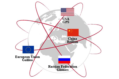
]]>Since then the European Union (EU) and China have both launched their own GPS networks. The former goes by the name Galileo and currently has 22 satellites in orbit with plans for 30 in total. The latter, BeiDou, which came into operation in 2000, has 22 operational satellites with plans to complete the network by adding 13 more by the year 2020.
And not to be left out, both Japan and India are developing regional GPS navigation satellites. Japan’s system, called the Quasi-Zenith Satellite System (QZSS) will have 7 satellites when fully operation by year-end. Currently, there are 4 satellites already in orbit. India’s Regional Navigation Satellite System (IRNSS) with 7 satellites is designed to cover the subcontinent and a region up to 1,500 kilometers around it.
The latest Russia-Chinese initiative appears to be a merger according to Izvestia with GLONASS and BeiDou becoming one system capable of sharing navigational data. It is hoped that in combining their GPS it will improve accuracy for both systems. Talks are scheduled for May of this year to complete planning for the new combined system. It will be interesting to see if the combined GPS will offer civilians and commercial operators the equivalent convenience that the American GPS network does today.
GPS has been revolutionary since the first satellites were deployed. The technology has become ubiquitous as GPS receivers have seen their form factor shrink to a point where they can be incorporated into almost any device from mobile phones, to farm machinery, laptop computers, airplanes, all kinds of transit vehicles, cars and trucks.
The U.S. military-grade version is accurate within a few centimeters. The civilian and commercial version is less precise but certainly more than acceptable. When my family drove to Cleveland last summer, and Atlanta, in the fall, the GPS in our Toyota Rav4 served us well. As I write this posting, my mobile phone is sitting beside me here on the desk and when I check location is pinpoints my whereabouts on Google Maps to be across the street from where I am, a deviation no more than 10 meters. That may not be good enough for engineering measurements, but for general navigation purposes, it appears to be more than sufficient.
So how did GPS come about? The idea was first conceived by a researcher who was an MIT graduate working at Raytheon Corporation. As early as 1951 the company proposed to the U.S. Defense Department, a three-dimensional, time-difference-of-arrival position-finding system. With the launch of Sputnik by the Soviet Union in 1957, the technology was finally in place to turn the Raytheon proposal into a reality.
And now we have six different technologies deployed and next-generation refinements coming out that will make these systems more robust, more pinpoint accurate, and cyber secure.
The post Russian Sources State that China and Russia to Merge Their Global Positioning Systems appeared first on Techso Mogro.
]]>